
Wild cycling
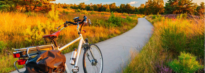
The perfect inspiration for anyone who loves to ride off road and get out into the wild and stunning scenery of the British mainland.
Wild Cycling means using bridleways, trails and tiny lanes to explore the countryside. but it isn’t just that: it’s a release and it is getting back to nature, and even more to our collective childhoods. That’s when most of us first got bikes. Remember how it felt? The freedom, the means to roam and discover places, and the visceral rush of bombing through the woods and bouncing over the bumps. It’s escaping traffic, living in the moment – but above all wild cycling is child-like fun.
In the following extract from his new book, Cycling Weekly writer and qualified cycling coach Chris Sidwells will bring you along for a wild cycle in Essex…
Dengie Marshes, Essex
A mostly on-road ride around a water-dominated landscape of big skies and lonely horizons
DIFFICULTY RATING 3/10 WILDNESS RATING 4/10
FACT FILE
Where The Dengie peninsula, about 16 kilometres south-east of Chelmsford
OS grid ref TQ 9583 9975
Start/Finish Southminster
Ride distance 34 kilometres (54.4 miles)
Highest point St Lawrence (34.5 metres)
Approximate time 2–3 hours
This is an easy one, mostly on-road, but the roads are nothing more than quiet lanes. Cycling along them, without thinking too much about navigation or surface hazards, frees up head-space to enjoy the unique landscape of the Dengie Peninsula, which is top-and-tailed by the Rivers Blackwater and Crouch and bordered by the North Sea.
Much of Dengie Marshes is inaccessible, because it is a fragile ecosystem supporting a rich and varied bird life. Most of it is a National Nature Reserve and specially protected. Even though access is restricted, quite rightly for conservation, you still see plenty on this ride. Look out for hen harriers in summer; the male’s striking blue-grey plumage gave rise to its nickname, the Grey Ghost.
Follow the B1201 north to Asheldham and take the first right, Hall Road. This becomes Keelings Road: follow it for a kilometre after the left turn to Dengie village. For a longer ride you could turn right down Bridgewick Lane and ride to the end of the road and back – this road runs
right into the heart of Dengie Marshes, so gives a better feel of the place. Otherwise continue left on Bridgewick Lane to Tillingham. Turn right on the B1021 and follow it to Maldon Road, where you go right to Bradwell-on-Sea. Turn right on East End Road, which is long, almost straight and probably Roman. It certainly leads straight to the Roman fort of Othona. Strictly speaking, then last 400 metres from the car park to the fort is a footpath, but you could scoot your bike along it if nobody is looking. I’ll leave the choice to you.

Othona was one of nine coastal forts constructed during the third century nas protection against Saxon raiders. Originally its defences were massive; its walls, arranged in trapezoid fashion, were 20 feet high and 14 feet deep, with towers at each corner. There were lots of Roman buildings inland from the fort, and Colchester, just to th enorth, was called Camulodunum, the capital of Roman Britain, Britannia,before it was destroyed during Boudicca’s rebellion in ad61. From the fort, retrace your route to Bradwell-on-Sea, turn right o nHigh Street, then second left on Trusses Road, and right on the B1021 to visit Bradwell Marina on the River Blackwater. This is a typical Essex creek landscape, except for the backdrop of Bradwell nuclear power station. This was powered by a Magnox reactor, but has now been decommissioned. There are plans to build a new nuclear plant here.
Retrace your route south on the B1021, and go first right on Maldon Road, which runs parallel to the River Blackwater. Turn left to St Lawrence, go left again at the T-junction, but at the 90-degree left-hand bend look for a bridleway on your right. This is the first of three off-road sections. Go right on the bridleway, which bends sharply left, then goes south along the east side of the hedgerows. There’s a sharp left and right after 800 metres, then the trail crosses an open field going south. Go left when it joins the drive to a private house. The trail soon switches south again, and eventually you hit Southminster Road at High House Farm. Turn right, and look for the bridleway on your left after Rushes Lane.
This trail runs south like the previous one, but west of the hedgerow; then it goes parallel with Asheldam Brook for 750 metres to Foxhall Road. Now turn right. The final bridleway section starts on your left after a kilometre. Follow it south through Shepcotes Farm, where it becomes Shepcotes Lane. Continue into Southminster, go left on North End and right onto the B1201, and back to wherever you started from in the town.